A very deep Mediterranean Low is coming soon
Vuoi salvare articoli per un rapido accesso?
Sali a bordo della community DN Plus.
Per te, un'area riservata con: approfondimenti esclusivi, i tuoi articoli preferiti, contenuti personalizzati e altri vantaggi speciali
Accedi RegistratiThe deep Low is determined by the effect of a Mediterranean trough connected to a vast vortex in transit over the North Atlantic
The deep Low is determined by the effect of a Mediterranean trough connected to a vast vortex in transit over the North Atlantic
This weather section is dedicated to the interesting situation expected for Tuesday 22 November in the Western Mediterranean Sea. The models are all aligned in describing a deep Low with a minimum value of 985 hPa centered on the Ligurian Sea precisely at 12 UTC on November 22nd.
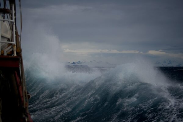
The situation is determined by the effect of a Mediterranean trough connected to a vast vortex in transit over the North Atlantic. Starting from Monday 21st, we will observe a reinforcement of the Libeccio (SW’ly winds) which will gradually extend from the Alboran Sea, to the Balearic area and the western coasts of Sardinia and Corsica, Provence and the Ligurian Sea.
Given the very extensive fetch (distance of open sea where the waves can propagate without encountering obstacles) the first signs of deterioration will first be noticeable through the increase in wave motion, starting with the swell that often precedes the arrival of the perturbation on all coasts exposed to western flows.
It is interesting to observe, which you can do by following the projections and synoptic maps on the various reference sites of the National (Met Office, Meteo France, Meteoam) and Regional (LaMMA) Weather Centers as well as on the very useful weather portals (for example www.windy.com), how the depression that deepens during the night of Monday the 21st over Provence and quickly moves over the Ligurian Sea on Tuesday, deepening to 988hPa and then moving East, over the Northern Adriatic on Tuesday night.
Francesco Pasi – Researcher CNR Meteorologist at LaMMA Consortium and AMPRO
There are some elements connected to the evolution of this meteorological event that you can follow with attention.
1. The value of the atmospheric pressure indicated by the barometer or barograph is very important. Every ship, yacht or boat is equipped with this very helpful instrument. Practical experience teaches us that when the pressure drops below 1000 hPa the associated phenomena are generally intense.
2. The force of gradient winds (generated by pressure differences) which you can see by how close the isobars are on Tuesday. Close isobars mean strong winds, very close isobars stormy winds.
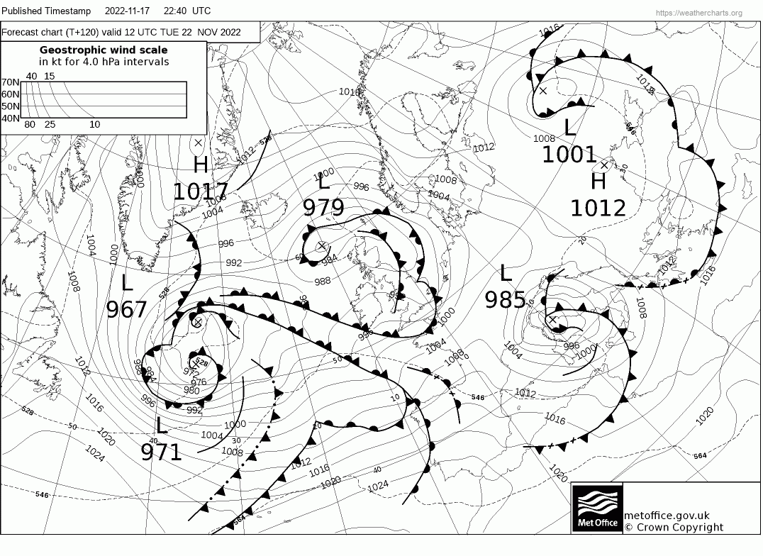
Forecast Met Office for Tuesday 22nd November
3. The speed with which the vortex moves from West to East is important since the dominant direction of the winds depends on this because, as you know, winds rotate counterclockwise around the depressionary vortex in the Northern hemisphere.
4. The areas affected by stormy winds change rapidly since the movement of the Low on the Adriatic Sea Tuesday night causes strong SW’ly winds veering to the NW on the islands of Corsica, Sardinia and Sicily and on the Tyrrhenian Sea.
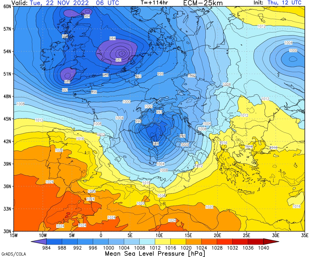
Mean Sea Level Pressure
5. When the Lows are deep, the sea level also tends to rise compared to the mean sea level. This indicator, as shown in previous situations, can easily exceed half a meter. This takes on greater significance if it coincides with high tide. In these situations, the impact of breaking waves on the coasts can be greater than what is indicated by the meteorological models. This is an aspect that should not be underestimated.
6. The incursion of strong northerly winds will initially generate a cold front and some fast lines of thunderstorms. Before the Mistral wind dissolves the clouds, thunderstorms will also need to be monitored carefully.
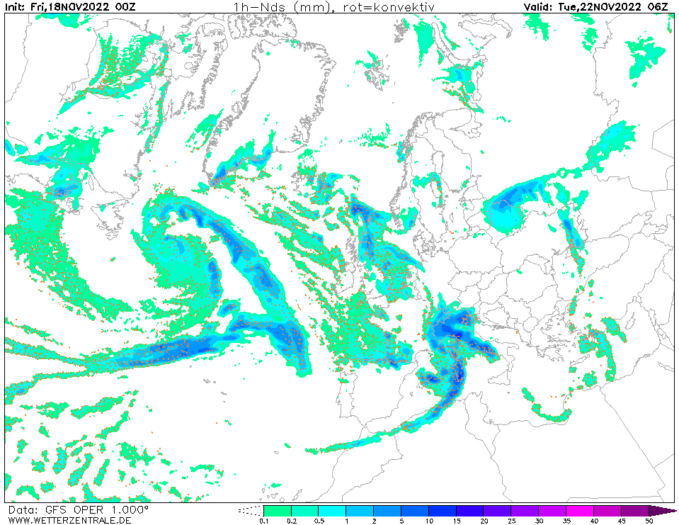
GFS – Precipitation valid to Tuesday 22nd November
There are a few days left before the meteorological event described. It will be interesting to gradually follow the indicated weather evolution which will require attention from the entire maritime industry, the nautical sector, ports and operational activities on the coasts such as maritime works.
Gianfranco Meggiorin
Navimeteo President & Monaco Weather Lab Coordinator